


Oak Leaf Trail
The Oak Leaf Trail is a multi-use trail system with over 135 miles of trail. In 2024, more than a half million trail users passed the Brady Street Bridge! Paved mostly with asphalt, the trail has dozens of easily accessed connections to its seven main 'branch lines' and scenic loops. Portions of the trail are located on parkways and municipal streets, where you'll share the road with automotive traffic. Segments of the trail that run through parks may be used when the parks are open, generally from 6 a.m. to 10 p.m.
Popularity of the Oak Leaf Trail System by Traffic Count
| Trail Counter Location | Annual Traffic Counts |
|---|---|
| Kinnickinic Line at East Maple Street | 148,596 |
| Menomonee Line at North Swan Boulevard | 171,250 |
| Milwaukee River Line at Brady Street Bridge | 566,134 |
| Milwaukee River Line & Zip Line at East Providence Avenue | 383,934 |
Wayfinding & Signage

- Print or screen shot the Oak Leaf Trail Map to see how routes connect.
- Open the Interactive Trails Map for on- and off-street trail segments, closures, detours, and historical stops along the way.
- Look for wayfinding kiosks throughout the trail system for additional detailed maps.
Highlights of Trail-Use Guidelines
- Obey all traffic signs and signals, follow trail closures and detours, and respect maintenance staff.
- Stay on designated trails.
- Travel at responsible speeds that are safe for conditions.
- Stay on the right, pass on the left.
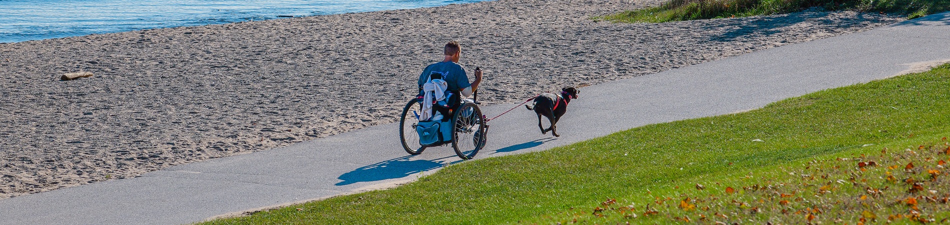
- Keep pets on a short leash and pick up after them.
- Be visible and use lights when traveling in low-light conditions.
- Wear a helmet (strongly recommended).
Lines (Routes)

Menomonee Line
Starting from Dretzka Park in the northwest corner of the County, the Menomonee branch follows the Little Menomonee River Parkway and the Menomonee River Parkway. The trail passes through Currie Park and Hoyt Park before reaching downtown Wauwatosa. The branch line then follows the Honey Creek Parkway past Jacobus Park and on to Doyne Park.
Dretzka Park - Doyne Park, Approx. 14.75mi

Root River Line
LONG-TERM TRAIL CLOSURE: in the area of Watertown Plank & North Mayfair roads
(Underpass bridge is out at Hwy 100)
See the Interactive Trails Map for a detour
The south western section of the Oak Leaf Trail travels from Hansen Park in Wauwatosa down to the Milwaukee County Sports Complex in Franklin. The trail connects with the Hank Aaron State Trail on Underwood Creek Parkway and the New Berlin Trail in Greenfield Park. The trail follows the Root River parkway for much of the trail.
Hansen Park - Milwaukee County Sports Complex, Approx. 19mi

Oak Creek Line
The south eastern section of the trail connects the southern edge of the Root River Parkway with the Oak Creek Parkway via an old railroad track (the North Shore Right of Way). The trail connects with the South Shore Line.
Root River Parkway South - Abendschein Park, Approx. 8 mi

Kinnickinnic Line
This east-west section connects Wauwatosa with downtown Milwaukee. The trail passes through Jackson Park and McCarty Park following the Kinnickinnic River Parkway, and uses sections of the Honey Creek Parkway to connect with the Menomonee Line in Wauwatosa. The line connects with the Hank Aaron Trail at State Fair Park.
Museum Campus - Hart Park, Approx. 15mi

South Shore Line
The South Shore Line tracks the shoreline of Lake Michigan from Cupertino Park in Bay View, down through South Shore Park, Warnimont Park, Sheridan Park, and Grant Park. The trail then follows the Oak Creek Parkway before taking a new section of trail back to the lakefront in Bender Park.
Cupertino Park - Bender Park, Approx. 16 mi

Milwaukee River Line
This section of trail begins in downtown Milwaukee along the lakefront, travels through the city on a section known as the Eastside Trail before connecting with the Milwaukee River and tracking the river north through Estabrook Park, Lincoln Park, Kletzsch Park and on to Brown Deer Park.
Juneau Park - Brown Deer Park, Approx. 14mi

Zip Line
This section of trail branches off of the Milwaukee River Line and provides a direct, traffic-free connection from Estabrook Park to Brown Deer Park by following an old rail line. The line is named for bicycling advocate Harold "Zip" Morgan, who first conceived and laid out a 64-mile trail in 1939.
Estabrook Park - Brown Deer Park, Approx. 6mi
Brown Deer Park - Kohl Park, Approx. 3mi

Drexel Connector / Bradley Connector
Bradley Road in the north and Drexel Avenue in the south provide east-west connections between trail lines. Portions of these connectors are on municipal streets, with traffic.
Bradley Connector, Approx. 3.3mi
Drexel Connector, Approx. 4.5mi

Lake Park Loop
The Lake Park Loop is a scenic ride along Milwaukee's lakefront. The line begins at the Milwaukee Art Museum and follows the shoreline through Veterans Park, McKinley Park and Bradford Beach, before continuing on to Lake Park and ending at the Northpoint Lighthouse.
Lake Park Loop, Approx. 8mi
Whitnall Park Loop
The Whitnall Park Loop branches off of the Root River Line for a scenic ride through Whitnall Park. Beginning at the Whitnall Beer Garden, follow the loop past Boerner Botanical Gardens and along the parkway. Stop at Wehr Nature Center or Whitnall Golf Course too.
Whitnall Park Loop, Approx. 3.5mi
Detailed Trail-Use Guidelines
Because the Oak Leaf Trail is made up in part of parkway drives and municipal streets, you must obey all traffic signs and signals.
Obey All Signs & Signals
- Follow the Rules of the Road.
- Do not weave in and out between parked cars.
- Use proper hand signals.
- Walk your bike at busy intersections.
- Skate on city sidewalks when on municipal street segments. Skating is not allowed on city streets.
- Obey trail closures and respect maintenance staff.
Stay on Designated Trails
- Respect plants, wildlife, and other neighbors along the Trail.
Travel at Responsible Speeds—Safe for Conditions
- Slow down when approaching a turn or other users.
- Be prepared to slow down and stop.
- Yield to those already on the trail and yield to slower traffic.
- When going downhill, yield to uphill traffic.
Stay to the Right
- Ride, walk, run, or skate on the right-hand side of the trail with the flow of traffic.
- If you stop on the trail, please step off to the side of the trail.
Pass on the Left
- Alert people before passing them by calling out, "On your left," or by using your bell.
- Look for acknowledgment when passing and acknowledge when being passed.
- When passing or being passed, do so single file.
Be Aware of Your Surroundings
- Be aware of others around, in front of, or behind you on the trail.
- Limit distractions by not using a phone or headphones.
Keep Pets Leashed & Pick Up Their Waste Immediately
- Use a leash no longer than 6 feet.
- Pick up your dog's waste and dispose of it at your home.
- Do not let your dog go into an area posted “No Dogs Allowed.”
Be Visible
- Use headlights and red rear reflector/ light when traveling in low-light conditions.
- Wear brightly colored or reflective clothing.
Wear a Helmet / Use Protective Gear (strongly recommended)
- Care about your brain! Wear a helmet when riding your bike.
- Use protective equipment such as knee or elbow pads when skating.
Use Increased Attention When Riding in Groups
- If more than 10 people are in your group, consider traveling in multiple smaller groups or waves.
- Only ride/walk/run two abreast so as not to cause a hazard to others.
- Allow enough room between participants to transition into single file.
Follow Additional Rules When Using Electric Bikes or Scooters
- Follow all of the same trail guidelines as other users, but always ride single file.
- Keep maximum speed below 20mph.
- Do not leave electric scooters on the trail, parkways, or in any area where they can block the right of way.
Questions?
Contact the trails coordinator with your questions. Call Jacob Sanchez at (414) 257-5087.